This was my first legitimate mountaineering experience. While consistently visiting the Beartooths for the past year, the thought of finally attempting Granite Peak -- the highest point in Montana and one of the most difficult in the lower 48 -- was forming in my head. The only other big mountain climb that I had done was the Grand Teton, at the invitation of Paradox Sports. However, that would not have been possible without the help of the highly experienced Exum Mountain Guides.
Granite was a whole other equation. This time, I would play a huge part in the decision making process -- Where to go? Which route to take? What to bring? And everything else that goes through the mind of someone in the backcountry. I had come by these questions before, and had even worked through many while touring during the winters, but I was still new to the use of ropes to summit. Fortunately, we found Kevin in the nick of time.
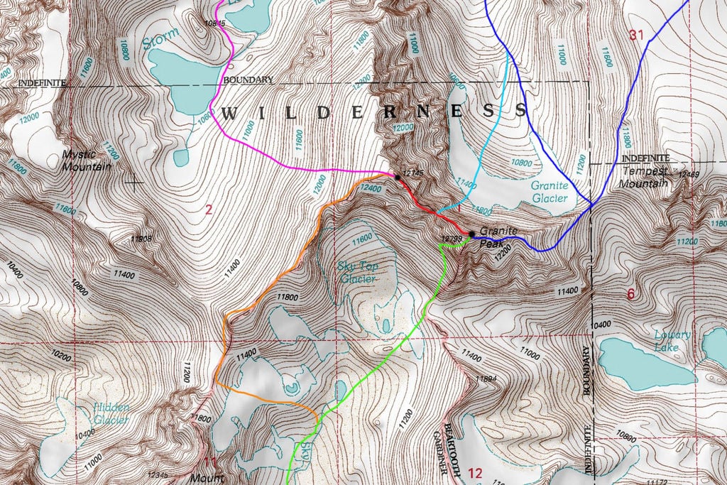
DARK BLUE: Granite Peak East Ridge - Class 4 (Chosen Route via Froze-to-Death Plateau in NE corner) LIGHT BLUE: Granite Peak Notch Couloir - Class 5.4 and Steep Snow GREEN: Granite Peak Southwest Couloir - Class 3 RED: West Granite to Granite Peak Traverse - Class 5.4 ORANGE: West Granite Peak Southwest Ridge - Class 2+ PURPLE: West Granite Peak West Face - Class 2
Prior to the climb, we had been asking around the Bozeman area for someone who either wanted to join or would let us borrow their pro rack. Of course, the latter was a long shot, so getting someone a little more experienced for the last 500 ft of the climb was the next best thing.
Being a local Bozemanite and a climber since 12 years of age, Kevin brought more rope experience to the table than both me and Spencer combined. Having met Kevin, through Conrad Anker of all people, was lucky to say the least. In addition, for him to be interested and able to commit just three days prior to the trip was a huge relief, especially considering the scope of what we had decided to undertake.
Spencer and I had been in the Beartooths a month prior to the trip when we started showing interest in tackling Granite. We pulled out maps, sought out beta, and discussed various ways to go about approaching it. Spencer, like me, has a good deal of backcountry knowledge and leadership skill. Furthermore, being a native Vermonter and a guide on dozens of trip in the backcountry of the Adirondacks, Spencer very much remains a backpacking chef and guru. I have learned a great deal from the many experiences I have had with him, and am always keen to learn more. As Mr. Bill Nye the Science Guy once quoted “Everyone you will ever meet know’s something you don’t.” I follow that fully and so far it has held true.
Many have summited Granite in just one day, with the first ascent in August 1923 by Elers Koch, James C. Whitham and R.T. Ferguson a group of forest service officials. However, I am not the fastest hiker known to mankind. Yet, I also adhere to the philosophy that life is not a race to the finish. Taking in the sights and breathing in fresh mountain air is what I live for. Usually holding up the rear in a group on any hike or tour, I’m glad to say I’ve gotten the chance to appreciate and cherish my hikes. The hike for me remains a chance to meditate on the natural world instead of quickly summiting without understanding it’s beauty.
The Ascent
Spencer and I, having to work until 3 p.m. or so on the departure day, made this a true weekend warrior test -- an ode to all dedicated individuals out there exploring the unknown with just two or three days time. With that, it was a 6:30 p.m. arrival to the West Rosebud trailhead followed by an ambitious attempt of 5+ miles to the start of Froze-to-Death by the night. Well, that didn’t happen. As we gained elevation to our first destination, Mystic Lake, a thunderstorm was brewing just a few miles to the south. We had reached the first talus field and could see the fast approaching storm muddled by classic summer forest fire smoke, making it difficult to tell the severity of the weather. Finally, as the rain started coming down, we pulled the plug on our goal to reach the plateau and set up camp two-and-a-half miles from the trailhead. It was the safest option. All three of us assumed snow in the forecast for the plateau that night.
We called it a night at 9:30 p.m. and set our watch alarms for 4 a.m. An early start would be an early descent from the peak. Always a good call.
As I heard the buzzing of my alarm at pre-dusk, an additional noise was prominent: the sound of rain hitting my tent. I called out to Spencer and Kevin, “You guys up?” and received a couple yes’s in in response. “Let’s wait it out,” I then mumbled in my stupor, hoping this precipitation would only last another few minutes. The second *BUZZ* came at 5:15 a.m. Shoot! Well, at least I slept well. Waking and peering outside, I saw the rain had stopped. I began breaking down camp and could hear the other two doing the same.
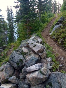
As the clock ticked 6:15 a.m., we set foot on trail. Thoroughly expressing our dismay of "The Switchbacks from Hell," we began the three-mile section of over 26 switchbacks. Luckily, as we approached this grueling task, we came to realize the route was one of the most well maintained we had ever been on -- retaining rock walls, with moderate pitch (though not too steep) and completely cleared of dead tree debris. The list goes on. It was apparent that someone had done an unbelievable job on the building of this pathway. We assume the Conservation Corp had a hand in it.
Then, gaining elevation one crutch plant at a time, I started to notice the clouds from the previous night’s rain clearing out. The smoke seemed like it was there to stay, but it was thinning out. However, we were wary of fire conditions -- if the smoke was too inhibiting we’d scratch the mission and stay around Mystic Lake. Thankfully, as the sun woke up, that was not the case. The smoke had thinned and we could now make out the enormous walls that surrounded the lake. I was getting lost in my imagination and could picture climbing some of these behemoths. Just how rewarding would it be to be at the top? Later, it always feels like a masochistic addiction, a type B fun for the sake of euphoria and one hell of a story.
We slowly transferred from the montane to sub-alpine zone as the destination of the plateau neared. Putting the switchback series into perspective, the Lake is based around 7,500 feet and the Plateau around 10,000 feet, depending on location. A quick elevation gain that takes about two-and-a-half hours kept us somewhat on track. Next up was the plateau itself.
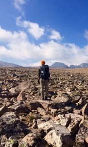
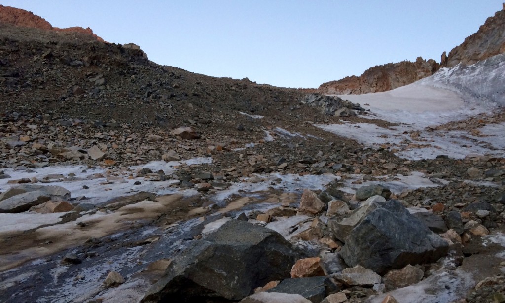
 First steps on Froze-to-Death Plateau. Photo by Vasu Sojitra.
We soon figured out the epithet ‘Froze-To-Death’ was most appropriate for this next segment. However, a few layers later, we veered south to enjoy the moderate uphill the Plateau had to offer; an elevation gain of around 2,000 feet expanding over four miles on which the cairns played a huge role. Following them over mossy and wet sub-alpine terrain was pleasant on the foot and hands. During the planning of this trip, the fatigue of my hands and palms was a major concern of mine. On most trips, a hot burning sensation starts to form after a few miles of hiking. Little bit of this natural cushion for the pushin’ was helpful however, it did soon transition into talus and boulders as expected. Precise placement of the crutches was key when traveling through this terrain.
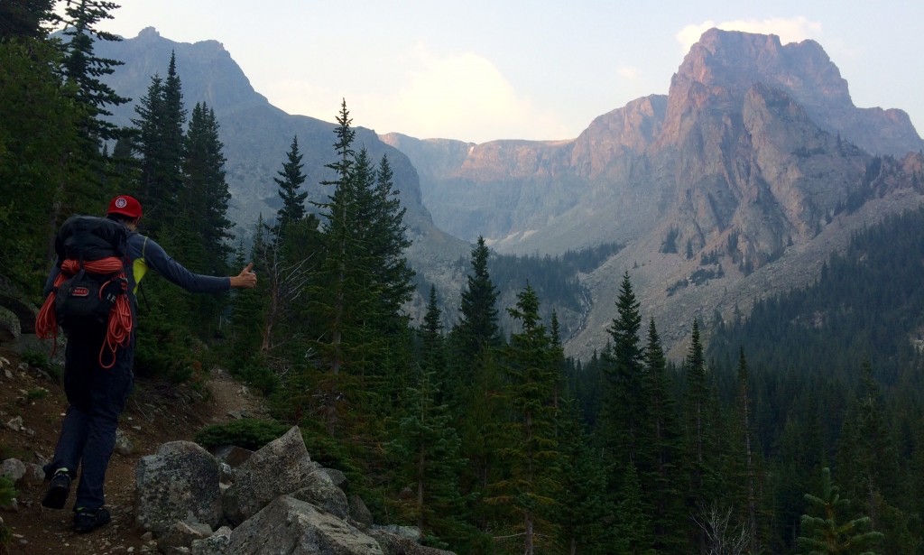
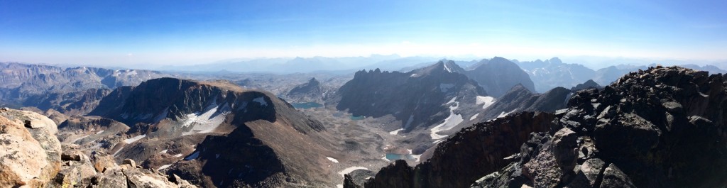
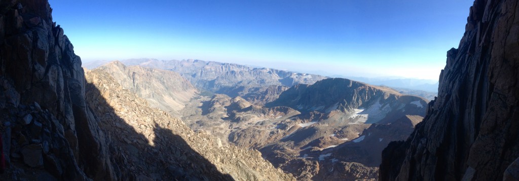
It was around 1 p.m. when we wandered up to the Tempest Mountain basecamp, just north of the Tempest Mountain Summit. A few mountain goats welcomed us to the scenic view of the Granite Cirque. This was the first time any of us had see Granite in all it’s beauty -- intimidating to say the least. The north face is a fluid array of beautiful granite walls while the Granite Glacier sleeping at the base and filtering into Avalanche Lake. The south face peaks into the vast ecosystem that is the Beartooth Plateau with seemingly endless mountains and alpine lakes. And finally, the knife-edge spine runs to the top of Montana. This feat is the last to overcome in our micro-adventure.
A few sips of water and a refill at a small spring pushed us onward. Assuming the final leg would take a couple hours -- putting us at the peak at 3 p.m. -- we kept a steady pace descending to the Tempest and Granite Col. Full of rock and scree, my ninja stickin’ had to be on point. Placing the crutches in the smallest of cracks and cam-ing them between rocks was the name of the game. Shoulders felt good, hand were ok, rock and roll! Crossing over the Col and staying on the east side of the knife edge made for a pretty straight forward scramble up until the well known snow bridge, the supposed crux of the route. It was a dry winter season and a warm summer so there was no worry over sketchy snow crossings.
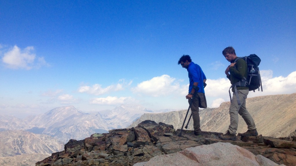
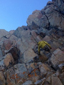
Then with only half a mile to go, we roped up for the final exposed sections -- a few pitches of 5.3-5.5 climbing -- nothing crazy that one of us couldn’t handle. This could’ve been done without ropes, but if weather had rolled in, like it tends to do in the Beartooth’s, having that extra security would be crucial. So slowly, but surely, we inch wormed our way up via simul-climbing -- Kevin leading, me in the center and Spencer cleaning. A few hiccups of veering off route slowed us down, but we pushed on. The “Keyhole” to the summit was in view and the stoke level was at an all-time high. We were itching to summit regardless of time.
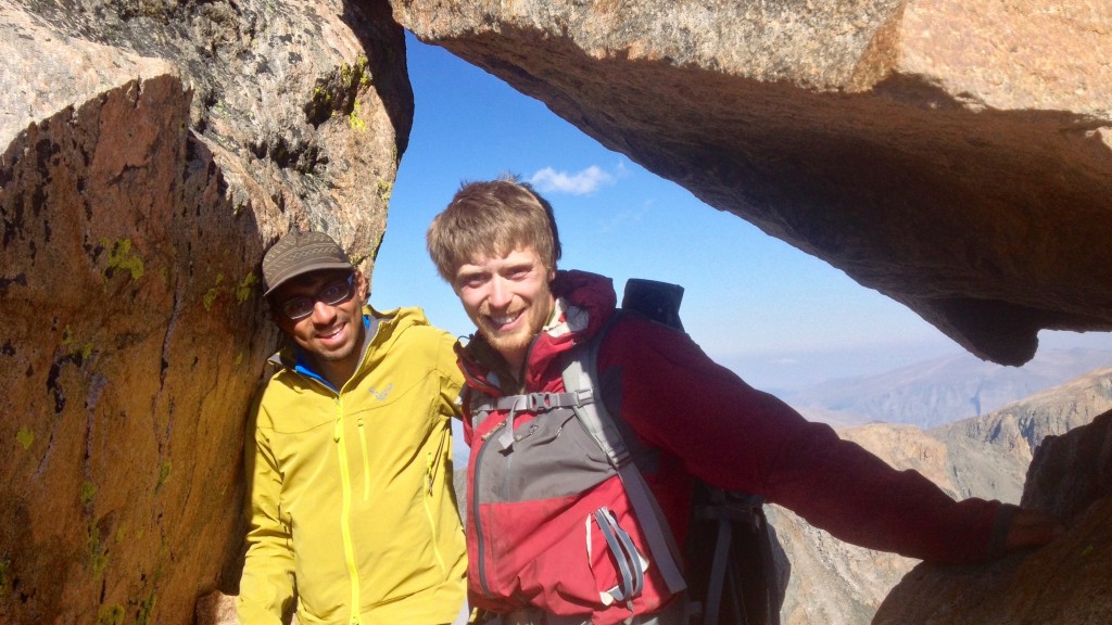
Then, at last, I grabbed on to any hold I could find. Slowly being able to touch the sky from a long day's effort was awaiting us. And the mission was accomplished! Just like that, we had made it. Time of summit 4:18 p.m. We celebrated, snapped a few photos, and rested. A feeling of rewarding solitude was what we received. Such bliss.
The Descent
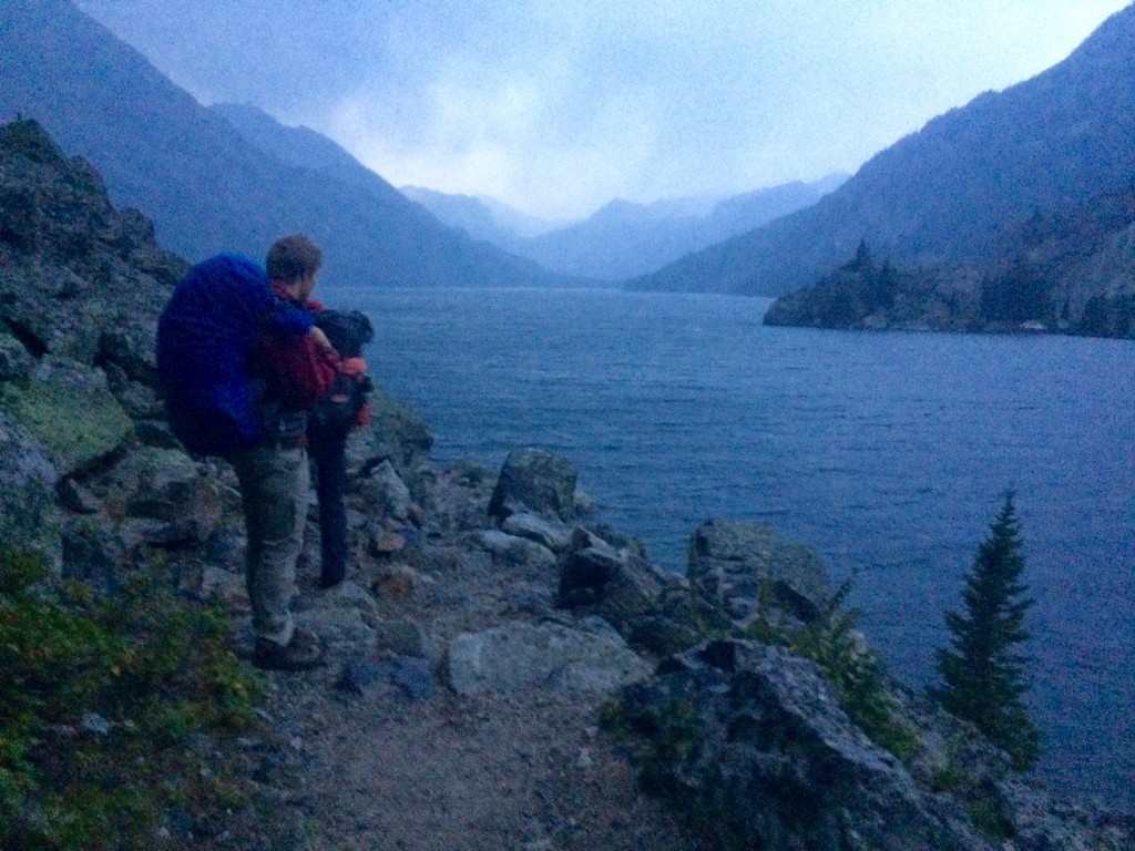
Awaking from our euphoria, we quickly divvied up the gear. Time for the long journey back home. Rappelling, down climbing, scrambling and deep breaths. We made it back to the Col and took a quick break. Our plan from the start was to hit the Plateau again and head back down “The Switchback from Hell”, but a spontaneous decision, mainly mine and Spencer’s, was to head down to low elevation and to Avalanche Lake. We felt it would be safer and the trail back would be a breeze once we hit the north end of the lake. However, Kevin’s opinions on this strongly opposed ours. We should have thought twice. Spencer and I quickly realized and regretted our mistake, but by then it was too late to turn back.
The talus field to the lake was brutal. It took us until sundown to get to the water and once there, the trail was nonexistent. Boulders, scree, and ankle breaking cracks were the road ahead. Always concerned about what was around the next bend -- a rock wall, a stream, more scree, or even wild animals -- we were constantly on our toes for the next eight miles. It turned into one of the longest nights of our lives.
We slowly reached the north end of the lake, but not without a scare. Over one of the many boulder fields we crossed, we suddenly encountered two sets of eyes staring at us. “On my god, It’s a wolf!” Kevin screamed. This of course made me and Spencer jump. Hearts racing and not completely sure what we had gotten ourselves into, we stood there like deer in headlights. After a few second of observing the eyes with our headlamps, we quickly realized they were attached to a pair of mountain goats. “Man, that was a close call.” I said in relief. It was quite a wake up call.
After that, we continued onwards, frequently trying to figure out which direction was correct. Small cairns and quick glances at the map directed us around the perimeter of the lake, which occasionally felt like deep water soloing. Then having made it to the north end, we were greeted by an oversized cairn that signifies a welcome to Avalanche Lake for incoming hikers. However, we still met with no signs of our trail. Being almost midnight by then, we followed an alternate trail out, which ran parallel to Huckleberry Creek with connect-the-dot lakes all in between us and Mystic Lake. This was no ordinary hiking trail. It included a lot of boulder hopping, bog and river crossings, and bushwhacking though thick forested areas. It seemed to have been made by years of trail blazing and nothing else. This was something we were not expecting. By the end we were completely strung out. It truly made us appreciate the work that goes into maintaining trails in the wilderness.
Slowly making our way along Huckleberry Creek, each one of us seemed immersed in thought, and trying to stay awake and injury free. We finally got onto a well-beaten path around 4 a.m. and saw there were only a couple of miles left. My hands were on fire! I kept changing my grip every step, but not much was helping. On top of this, my body was feeling the overexertion by my stomach telling me so. The several chocolate bars, the dozens of ginger chew, the quarter pound of pepper jack cheese, the quarter stick of salami, and the soggy hummus wrap brewed uncomfortably in my stomach, but I was not going to let them go. This made it so I could only continue at a sluggish pace.
Hands burning, stomach churning, and head spinning, I didn’t even want to know what the other two were going through. All I knew was how bad I felt for making the decision to change plans. Under no circumstances would Kevin want to join us on another trek, let alone keep climbing together. That thought was constantly floating around in my mind. The thing that made me doubt this complete end to our relationship was the fact that Kevin said “that was worth it” once we had finally got back to camp. I’d say I genuinely agree with him. Of course, I regret making that decision, but as I have learned through my little adventuresome life, having regrets is what makes us human. It helps us in making future decisions and the event itself tends to be an incredible learning experience.
Now onto the next adventure!